Google Maps vs Waze: Which Navigation App Is Best for Your Daily Commute?
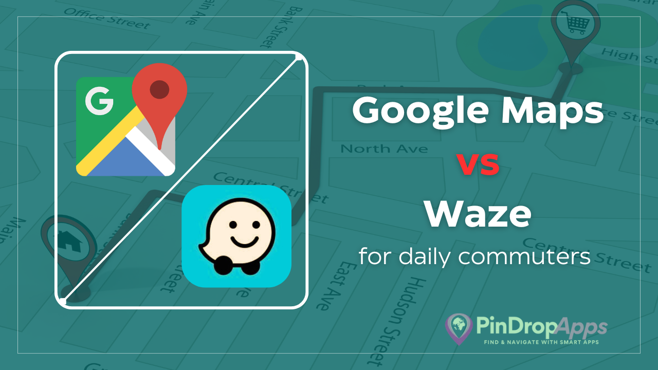
If you face a daily commute snarled with traffic, you’ve probably wondered whether Google Maps or Waze is the better companion for your drive. Both apps are extremely popular for daily traffic navigation, and each has loyal fans.
In fact, many drivers search for comparisons like “Google Maps vs Waze for commute” or “best navigation app for traffic” to figure out which one will save them more time on the road. Google Maps and Waze are both owned by Google, but they take very different approaches to navigation.
This blog post will compare Google Maps vs. Waze for commuting across all the key factors that matter for a daily driver: real-time traffic updates, ease of use, route optimization, time estimates, incident alerts (like police or hazards), battery/data usage, and integration with Android Auto/Apple CarPlay.
By the end, you’ll have a clear picture of each app’s pros and cons for your daily drive, helping you decide which is the best app for your commute.

Overview of Google Maps and Waze
Google Maps is a comprehensive mapping service that most of us have used at some point. It offers navigation for driving, walking, biking, and public transit, and is packed with information about places, businesses, and landmarks.
Google Maps leverages Google’s vast data resources – it has detailed maps worldwide and years of historical traffic data. It’s like a multipurpose tool: great not just for navigation but also for discovering restaurants, checking transit schedules, reading reviews, and more.
For navigation, Google Maps aims to get you from point A to B efficiently and safely, often using historical data and real-time conditions to choose the best route.
Waze, on the other hand, is a navigation app built specifically for drivers. Acquired by Google in 2013, Waze remains a separate app with a very different philosophy. Waze is all about community-driven, real-time information. Its maps and routes are constantly updated by the collective input of drivers on the road.
When you use Waze, you’re not just a user – you’re part of a crowd-sourced network, automatically sharing road speed data and optionally reporting incidents like accidents or police traps. Waze doesn’t have transit maps or extensive point-of-interest info; it’s laser-focused on driving cars or motorcycles.
This focus means Waze often feels like a dedicated traffic-fighting tool for commuters. It’s known for aggressively trying to save you time and for surfacing every little road alert shared by fellow users.
Both Google Maps and Waze are free to use and widely available. They work on both Android and iOS devices, and both are compatible with Android Auto and Apple CarPlay.
That means no matter what smartphone or car infotainment system you have, you can use either app on your daily commute. Now, let’s dive into how they compare on the features that matter most to a daily driver.
Real-Time Traffic Updates and Data Accuracy
One of the most crucial factors for any commuter is real-time traffic information. Both Google Maps and Waze provide live traffic updates, but they do so in distinct ways:
Google Maps Traffic Data
Google Maps gathers traffic info from a huge number of sources. This includes historical traffic patterns, data from local transportation agencies, and anonymized location data from millions of Google Maps users on the road.
When you see yellow or red lines on Google Maps indicating slow traffic, that’s the product of all that data. Google Maps will show congestion, estimated delays, and even report broad issues like “accident ahead” or “construction on your route.”
Over the years, Google Maps has gotten very good at depicting traffic jams and travel times. However, Google’s approach is more data-driven and less dependent on manual reports. While users can report incidents in Google Maps (a feature added more recently), the app largely runs on autopilot with its data – you as the driver mostly just follow its routing suggestions.
Waze Traffic Data
Waze takes a more crowd-sourced approach. The moment you open Waze, it starts sharing your speed and location (anonymously) with the Waze network to contribute to live traffic info. If there’s a sudden slowdown on your highway, Waze users ahead of you likely caused the app to flag it within minutes.
But beyond just passive data, Waze heavily relies on active user reports. Drivers can tap a button to report a traffic jam, accident, road closure, or other incident in real time. Waze then instantly alerts other nearby users. This means Waze can sometimes reflect on-the-ground conditions faster than Google Maps.
For example, if an accident just happened minutes ago, Waze drivers might mark it and all Waze users behind them will know right away. Google Maps might take a bit longer to reflect that incident if it’s relying on detection via speed data or official sources.
In practice, both apps do a solid job at warning about traffic slowdowns. But Waze often has an edge in very immediate, hyper-local updates, thanks to its army of volunteer reporters.
If there’s a sudden pothole, debris on the road, or a car pulled over on the shoulder, Waze users will flag it and you’ll see it pop up on your map as a little icon almost instantly.
Google Maps has been catching up by adding the ability for users to report incidents like this, but its user base isn’t as report-happy as Waze’s community. Waze was built from the ground up for crowd reports, and it shows.
On the flip side. Google’s data-driven approach can sometimes give it a broader awareness of traffic patterns even when user reports are lacking.
In areas where not many people use Waze, Google’s approach could actually be more reliable since Google pulls info from anyone using Google Maps (which is a huge number of drivers).
Data accuracy
For highway commuting, you can usually trust either app to know where the traffic is. Waze might be quicker to alert you the moment traffic starts to slow or clear.
Google Maps might be a tad slower on reacting to changes by a few minutes, but it’s using historical trends to predict traffic too. For example, Google might warn you of “heavy traffic expected ahead” based on the usual pattern, even before the road actually backs up.
Navigation Style and Route Optimization
How each app uses that traffic data to actually route you is where things get really interesting. Google Maps and Waze often choose different routes for the same trip because their navigation styles differ:
Google Maps Routing
Google Maps typically tries to find a balance between the fastest route and the most practical route. It will certainly try to avoid major traffic jams, but it also considers factors like road class (preferring highways and main roads when possible), the number of traffic lights, and even new metrics like fuel efficiency and safety.
In fact, Google Maps introduced routing options that might not always be the absolute fastest by a minute or two, if a slightly slower route is deemed safer or more fuel-efficient. For example, if two routes are almost equal in time, Google might recommend the one with fewer stops or gentler turns, to save gas and reduce the chance of accidents.
Google also tends not to send drivers on crazy detours to save just a minute or less – it avoids overly complex side-street maneuvers unless there’s a significant benefit.
Waze Routing
Waze is aggressive about saving time. The app’s philosophy is basically: whatever shaves off minutes (or seconds) from your ETA, do it. Waze will happily route you off a congested highway and through a maze of side streets if it calculates that you’ll arrive even a couple of minutes sooner.
Waze is very aggressive at getting you around obstacles other users have reported – you can find yourself driving down strange winding streets just to shave a few seconds off your ETA. This can shave minutes off your commute, though it might send you through residential areas that some drivers dislike. That dedication to the fastest route is Waze’s hallmark.
Let’s consider an example: Say there’s heavy traffic on your usual route home. Google Maps might just alert you that it will take 50 minutes instead of 30 today and suggest one of the known alternate routes (like a different highway or major road) if that saves a good chunk of time.
Waze, on the other hand, might start directing you off every exit, winding through local streets, or zig-zagging around pockets of congestion, potentially getting you home in 45 minutes instead of 50 by constantly adapting.
Some drivers swear that Waze significantly cuts their commute on bad traffic days. In one real-world test in London, Waze suggested a 7-mile route taking 33 minutes, whereas Google Maps’ route of similar distance was predicted to take 43 minutes – Waze found some clever detours that shaved off 10 minutes. That’s a big difference, though it won’t always be that dramatic.
Rerouting on the fly
Waze will recalculate and pop up a new route suggestion the moment it detects something faster. It’s not shy about frequently rerouting if conditions change.
Google Maps also reroutes, but usually only if there’s a significant delay or if you’re going to save a decent amount of time. Waze might reroute for a 2-minute gain; Google might wait until there’s say a 5-10 minute issue.
The result is that Waze can feel more “chatty” – sometimes mid-drive you’ll get a prompt saying “Found a faster route, save 2 minutes” and you can accept or decline. Google Maps, in contrast, might only interrupt you if there’s a major incident ahead or if you’re about to lose a lot of time on the current path.
Another difference is route alternatives. Google Maps loves to show alternative routes on the map (usually grey lines alongside the blue main route), and you can easily select a different one at the start if you prefer.
Waze typically auto-selects what it thinks is best, though you can manually explore other routes in the menu. For commuters who like to choose from a couple of options (maybe you prefer a certain road), Google’s interface makes that easier to do upfront.
ETA Accuracy and Time Estimates
When you’re commuting, accurate estimated time of arrival (ETA) is gold. You want to know if you’ll make it by 9:00 am or if you might be late. Both Google Maps and Waze continuously update your ETA based on traffic conditions. How do they stack up on accuracy?
Google Maps ETA
Google has years of historical data and sophisticated algorithms behind its ETA calculations. It knows, for instance, that traffic usually builds up on your route around 7:30 am and starts clearing after 9:00 am, and it factors those typical patterns in.
Google Maps’ ETAs are generally quite reliable under normal conditions. If you regularly commute with Google Maps, you’ll notice the ETA might adjust a few minutes up or down as you go, but it’s usually not too far off by the end of your drive – unless an unexpected incident occurs (accident, sudden road closure, etc.).
Google tends to be a bit conservative with ETAs, which can be a good thing (better to under-promise and over-deliver). For example, it might initially say you’ll arrive by 8:45, but as you drive maybe it shaves off a couple minutes if things are a little better than expected. It seldom gives unrealistically low times.
Waze ETA
Waze, with its real-time focus, is also very good with ETAs and arguably even more responsive to real-time changes. As Waze users ahead of you report slowdowns or clear-ups, Waze will adjust your arrival time on the fly.
Many drivers feel that Waze’s ETAs are optimistic but achievable. Waze might tell you a shorter time initially than Google would, assuming that minor delays can be bypassed. Because Waze is willing to reroute dynamically, it often manages to keep its promise on the ETA by finding ways around trouble.
If traffic gets worse, Waze will try something else to keep you on the fastest possible path. The result is that Waze’s ETA might bounce around a bit if conditions are volatile, but it’s working hard to stick to the shortest time.
In head-to-head experiences, sometimes Waze and Google give identical travel time predictions, especially for straightforward trips. Other times, Waze might project you’ll arrive a few minutes sooner than Google predicts, and it will then hustle to make that happen.
Keep in mind though, if there’s a totally unpredictable event (say, an accident completely shuts down a road ahead and no one can move), both apps will end up with increased ETAs – Waze might have alerted you faster, but neither can perform magic to teleport you out.
For daily commuting, both apps learn from your routine as well. Google’s Commute feature can send you notifications like “Leave by 7:15 to arrive by 8:00” using typical traffic for that route and live conditions.
Waze has a Planned Drives feature where you can set your work arrival time and it will remind you when to leave, based on historical traffic trends for that time of day. So both leverage past data to help with future ETAs too.
Overall, you can trust either app to give a reasonable ETA and update it if things change. Waze’s on-the-fly adjustments and aggressive rerouting give it a slight edge in reacting to live conditions, whereas Google’s deep data might better anticipate known traffic surges (like that daily bottleneck that always happens).
User Interface and Ease of Use
When you’re dealing with bumper-to-bumper traffic on a Monday morning, the last thing you need is a confusing app. The user interface (UI) and overall ease of using Google Maps vs Waze can impact your experience:
Google Maps UI
Google Maps has a familiar interface for most people. The map design is relatively clean, but it shows a lot of information. You’ll see the names of streets, businesses, and lots of icons for restaurants, gas stations, etc., especially when you’re not actively navigating.
Upon inputting a destination, Google Maps will highlight the route in blue and you get a simple top bar with ETA, distance, and travel time, plus bottom tabs for details and alternate routes. It’s a polished, classic map look.
Many users appreciate that Google Maps has things like lane guidance (it will show you which lane to stay in for an upcoming freeway exit) and clear labels for upcoming turns. The search bar is powerful (backed by Google search, so you can type just about anything and find it).
Overall, Google Maps’ UI is robust, but some might find it a bit cluttered or overwhelming if they just want basic navigation. For example, if you’re stopped, the map might suggest nearby places or do other things beyond just navigation.
Waze UI
Waze’s interface takes a different approach. The map you see in Waze is more minimalistic in some ways – it emphasizes the road ahead and uses large icons for things like hazards or police. You won’t see as many points of interest on the map itself by default; instead, you see cute icons of other Waze users around you and any reports (like a crash symbol or a cop icon). The design is more cartoonish and playful compared to Google’s look.
Many drivers find Waze’s display easy to glance at quickly: it shows your next turn, your ETA, and any alerts in a bold way. The interface is optimized for driving, which means big buttons and not too much tiny text.
You can also customize Waze’s look to some extent – for instance, you can change your vehicle icon to a racecar, or use different color schemes for the map at night. Waze lacks some of Google’s finer touches like detailed lane diagrams on highway interchanges, but it does flash up arrows if you need to be in a certain lane at a split.
Finally, consider voice guidance. Both apps offer hands-free voice-guided directions. Voice guidance in Google Maps uses a straightforward tone (with limited voice options), whereas Waze is famous for its quirky alternatives – you can pick various voice personas (even celebrities during special promotions) or record your own voice. This fun perk can make your commute more entertaining.
As for voice control: Google Maps on Android integrates with Google Assistant, so you can say “Hey Google, navigate to [Work]” without touching your phone. Waze also supports Google Assistant on Android, and on iOS you can use Siri shortcuts (for example, “Hey Siri, get directions to Work using Waze”). Both apps support basic hands-free commands, which enhances safety for commuters who need to keep their eyes on the road.
In summary, Google Maps’ interface is information-rich and familiar, which is great if you want all that info and precision. Waze’s interface is driver-focused and minimalist in terms of what it shows (aside from the community alerts).
Ease-of-use for basic commuting is high in both, but Waze is arguably more streamlined for the singular task of driving navigation, while Google is a Swiss army knife with lots of options.
Traffic Alerts: Police, Hazards and Road Notifications
One of the biggest reasons many commuters choose Waze is for its infamous police alerts and hazard notifications. This is an area where Google Maps and Waze differ notably:
Waze Alerts
Waze will notify you about almost anything happening on the road ahead as long as another user reported it. This includes common issues like accidents, vehicles stopped on the shoulder, road construction, debris on the road, and yes – police speed traps.
If a car is pulled over ahead of you, Waze might pop up a little icon and even announce “Watch out, vehicle stopped on shoulder ahead.” If users report a hidden police car, Waze will show a police icon and often give a voice alert like “Police reported ahead.” These alerts are hugely popular with Waze users because they give you a heads-up to slow down or be cautious. Waze even shows the reported locations of speed cameras or red-light cameras.
In essence, Waze serves as the eyes and ears of the road through its community. On a long commute, those warnings about road hazards can be very helpful to avoid surprises. (It’s worth noting that Waze’s system relies on user input – so the accuracy depends on people marking things and marking them correctly.
In well-traveled areas, you’ll usually have plenty of reports; in more remote areas, there may be fewer alerts simply due to fewer users around.)
Google Maps Alerts
Google Maps, for a long time, didn’t offer these kinds of granular road alerts aside from general traffic congestion info. In recent years, Google integrated some features likely influenced by Waze.
Now, Google Maps will show things like reported speed traps, accidents, or construction as well – but the coverage and frequency are generally lower than Waze. For example, Google Maps might show a tiny icon indicating a speed camera on a road, or a construction icon if someone flagged it.
It tends to report only significant incidents (major accidents, road closures) and permanent or semi-permanent fixtures like known speed cameras. On my daily drives, I’ve noticed Google Maps occasionally alert “speed trap reported ahead,” but it’s rarer, and often that data is coming from Waze’s backend or from fewer users bothering to report in Google.
Comparatively, Waze is still far more active and detailed with these alerts. In one user test, Google Maps detected only two speed cameras on a 45-mile trip to London, while Waze got every single one. That shows how much more comprehensive Waze can be with community reports.
For a commuter, these alerts can make a difference. Knowing about a hidden police car might save you a ticket if you tend to speed. Being warned of a mattress in the roadway ahead (yes, Waze users will even report odd objects on the road) can prevent an accident. Google Maps might not catch those micro-level details as often.
That said, some people find Waze’s constant alerts a bit much. If your drive is full of issues, Waze might be pinging or talking a lot: “Traffic jam reported ahead”, “Police reported ahead”, “Object on road ahead” – some like the vigilance, others might find it noisy. You can customize what alerts you get sound for, but by default Waze tends to err on the side of telling you everything.
Google Maps generally stays quieter; it will alert you to big things impacting your route and otherwise not distract you too much. If a commute is relatively uneventful, both will be quiet. But when things are happening, Waze will inform you of every development, whereas Google might just adjust your ETA or reroute without explicitly telling you why (you’ll just see your arrival time change).
Integration with Android Auto and Apple CarPlay
Many commuters use their car’s built-in screen via Android Auto or Apple CarPlay. The good news is both Google Maps and Waze integrate with both systems. This means you can have either app show up on your car’s display and use the car’s touch controls or steering wheel buttons to interact, rather than fiddling with your phone.
On Android Auto, Google Maps is the default navigation app, but you can easily select Waze instead. Waze on Android Auto provides the same core experience – you’ll see the Waze map and alerts on your dashboard screen.
On Apple CarPlay, Apple Maps is default, but you can choose to open Google Maps or Waze on the CarPlay interface as well (since iOS 12, third-party nav apps are allowed on CarPlay). So no matter your platform, you aren’t locked out of using either app on your car’s screen.
Experience differences: Because Google Maps is a Google product, it’s very seamlessly integrated into Android Auto with voice commands (Google Assistant will work smoothly with it). Waze also now supports Google Assistant voice commands on Android Auto (you can even say “Hey Google, report traffic” and it will trigger Waze to flag a jam, for example), which is neat.
On CarPlay with Siri, you can’t control Waze via Siri quite as deeply (Apple limits third-party integration), but you can at least open the app through Siri by saying something like “Get directions to Home with Waze.” In practice, using Waze or Google Maps on CarPlay is pretty similar: you tap your destination or use voice, and you get the guidance on screen.
If your daily commute involves using your car’s infotainment, the choice of app can be made without sacrificing that convenience. One thing to note: if you’re an Android phone user, Google Maps comes pre-installed and you likely have to download Waze separately (and maybe set it up once).
If you’re on iPhone, you have to install Google Maps or Waze since only Apple Maps is built-in. But once installed, both apps work well with CarPlay/Android Auto.
Performance-wise, both run well on these platforms. Occasionally, users have reported minor hiccups with Waze on Android Auto in the past (such as a map freezing or connection drop), but these issues tend to get fixed with updates.
Google Maps, being the default on Android Auto, is usually very stable. On CarPlay, both apps are comparably solid. If you ever find one is acting up, you can always switch to the other as a backup.
In summary, integration with modern car systems is a draw – you won’t be limited either way. It’s more about which interface you prefer seeing on your dash during your commute.
Battery and Data Usage
Using navigation every day can have an impact on your phone’s battery life and data plan, so how do Google Maps and Waze compare in terms of battery drain and data usage?
Battery Drain
Running GPS navigation with the screen on will drain any smartphone battery fairly quickly. In general, neither Google Maps nor Waze is considered light on battery – you will likely want to have your phone plugged in during long commutes regardless of app. That said, some tests have shown Waze consuming slightly more power than Google Maps.
For example, one analysis found Waze drained the battery at an 824 mW rate vs Google Maps at 745 mW (in a controlled test scenario). In practical terms, Waze might use roughly 10-15% more battery than Google Maps over the same period of navigation.
This could be due to Waze constantly communicating for real-time updates and perhaps rendering more moving parts (like other Waze users on the map). Google Maps was a bit more battery-efficient in that test.
On the other hand, Apple Maps was even more efficient than both, but that’s a separate discussion.
In day-to-day use, the difference in battery drain might not be huge – you might not notice unless you frequently drive without charging your phone. If you forget to plug in, Waze might eat, say, 20% of your battery on a 1-hour drive whereas Google Maps might eat 15% (your mileage may vary).
Lots of factors like screen brightness and phone model affect this too. Bottom line: both apps use significant battery (GPS + screen is heavy); Waze possibly a bit more, so just ensure you have a charger handy for long commutes.
Mobile Data Usage
Both Google Maps and Waze are surprisingly efficient with data. On average, Google Maps uses about 0.5 to 0.7 MB of data for every 10 miles you drive. Waze uses even less – around 0.23 MB per 10 miles.
To put that in perspective, even if you drive 50 miles a day, Google Maps might use ~3–4 MB and Waze ~1–2 MB. That’s a drop in the bucket for most data plans (and far less than streaming a few minutes of music).
The difference is partly because Google Maps often preloads map data for the entire route ahead, whereas Waze loads map data on the fly in smaller pieces.
Offline Use
Google Maps lets you download maps of your region in advance, allowing offline navigation and saving data (albeit without live traffic updates).
By contrast, Waze has no offline mode – it stops receiving new road data or traffic info if you lose connection. Google’s offline maps are a significant advantage in areas with poor connectivity or if you have a very tight data plan.
You could download your entire city or region over Wi-Fi, and then your commute might use virtually zero data (aside from a small amount for any live traffic refreshes). With Waze, you really need a constant data connection to use it as intended.
Waze’s smaller mapped scope (about 72 countries covered vs over 250 for Google Maps) means outside of well-traveled areas, it might not even be available or have complete data – but in most cities and highways worldwide, Waze is accessible as long as you have internet.
To summarize on this front: Google Maps is a bit more data-heavy than Waze, but still very light in absolute terms (and you can go offline to save data entirely). Waze uses minimal data but absolutely needs a live connection.
For battery, Google Maps may have a slight edge in efficiency, but both will drain your phone on long drives if it’s not plugged in.
Google Maps Pros and Cons for Commuting
Let’s break down the key pros and cons of Google Maps for a daily commuter:
Pros of Google Maps
- Extensive Map Data & Coverage: Google Maps covers virtually everywhere and can be used for driving, walking, transit, etc. Great if your commute sometimes varies (e.g., you drive part way and take a train, or need to find an alternate route in unfamiliar areas). You’ll also have detailed information on businesses or stops along the way.
- Accurate Traffic Predictions: Very good at predicting typical traffic patterns and giving reliable ETAs using historical data. It won’t usually send you wildly off-course; it tends to choose reasonable routes that make sense.
- Multiple Route Options: Often presents a few alternate routes so you can pick your preferred way (e.g., avoid that narrow street you hate or choose the highway over back roads). Puts more control in the user’s hands if desired.
- Lane Guidance and Clarity: Provides clear lane assist for highway exits and complex interchanges, reducing last-minute confusion about where to be. This is helpful for stress-free commuting on unfamiliar parts of your route.
- Integration with Google Ecosystem: Syncs with your Google account, so it can pull in addresses from your calendar appointments, remember your frequent destinations, and even recall where you parked. If you use Google Calendar or search for places on desktop, that info carries over to your phone.
- Offline Maps: Huge plus for saving data or navigating areas with poor reception – you can still get to work even if your route goes through a cellular dead zone or if your data plan is nearly maxed out (though you’ll lose live traffic updates offline).
- Generally Less Distracting: Google Maps doesn’t bombard you with as many pop-ups or gamified elements. It gives you the info you need when you need it, and otherwise stays in the background. Some commuters prefer this “quieter” experience.
Cons of Google Maps
- Less Aggressive Rerouting: Tends to stick to its chosen route unless a major delay occurs. It might not always catch a small shortcut that could save a couple of minutes, meaning you could occasionally sit in traffic that Waze might have helped you avoid.
- Limited Community Reports: Fewer real-time reports of hazards – you might not know about every speed trap or object on the road. Google relies more on automated data, so it can miss the nuanced warnings (like “pothole ahead” or a hidden cop) that Waze excels at.
- Cluttered Screen (for some): Shows lots of map details and points of interest that you might not need during a commute. The interface can feel busy, especially when not navigating. If you prefer a simple, no-frills navigation screen, Google’s map can be a bit distracting.
- No Bonus Features for Drivers: Google Maps is very utilitarian. It doesn’t have the fun extras like Waze’s special voices, user ranks, or a sense of community. If you enjoy those aspects, Google Maps will feel plain.
- Advertisements and Suggestions: While Google Maps doesn’t have pop-up ads in navigation, it does show sponsored pins on the map and might suggest things like “Grab coffee at Dunkin’?” when you search for a route. These are easy to ignore, but they exist as part of Google’s ecosystem and some users find them annoying.
Waze Pros and Cons for Commuting
Now, here are the pros and cons of Waze for your daily drive:
Pros of Waze
- Best Real-Time Alerts: Unmatched community-powered alerts for traffic jams, accidents, police, road debris, weather hazards, and more. You’re always in the know about road conditions ahead, often in real time. This can make your commute safer and help you avoid delays or tickets.
- Aggressive Time-Saving Routes: Optimizes heavily for the shortest travel time, often shaving minutes off commutes by routing around traffic in clever ways. Great for time-crunched drivers who absolutely need to minimize travel time and are open to unconventional routes.
- Simple, Driver-Centric Interface: Clean layout that highlights just what a driver needs – your route, your next turn, your ETA, and any relevant alerts. It doesn’t overload you with extraneous info about nearby businesses unless you ask. Many commuters find it easier to focus on driving with Waze’s UI.
- Fun and Personalization: Ability to choose humorous navigation voices (including occasional celebrity voices) or even record your own directions. You can also change your “mood” icon and see other Wazers on the road. These elements add a bit of enjoyment to an otherwise routine drive.
- Community and Gamification: Waze makes contributing to the app fun (you earn points and can ascend to different user ranks for reporting events). There’s a sense of community – a feeling that drivers are helping each other out. This can be motivating and creates a dynamic, ever-updating map experience.
- Extra Driver-Centric Features: Waze can help you find cheap gas by showing gas station prices updated by users. It also has features like carpool coordination (in some regions) and integration with music apps (you can control Spotify from within Waze). These little extras cater to people who are in their cars a lot.
- Fast Reaction to Change: If something suddenly happens (like a road closure or heavy traffic due to an event), Waze will integrate that info and adjust routes quicker than any other app, thanks to user reports. You feel like you have a hyper-aware co-pilot.
Cons of Waze
- Car-Only Focus: It’s designed for vehicles (and motorbikes) only. There are no options for public transit, walking, or cycling. If your commute involves anything other than driving, Waze can’t help with those legs – you’d need to use another app for, say, the train portion of your trip.
- Requires Data Connection: You can’t download maps for offline use, so if you lose cell signal, Waze might let you down. In underground tunnels, remote highways, or if you hit your data cap, Waze’s functionality will be limited. (It will try to keep your last route loaded, but any changes or new routes won’t work without internet.)
- Potentially Odd Routes: The fastest route isn’t always the most comfortable. Waze might take you through residential neighborhoods, side streets with lots of stop signs, or make you do tricky maneuvers to save a minute. This can sometimes be more stressful or hardly worth the small time savings. Not everyone wants that level of “creativity” in their daily route.
- Visual Clutter of a Different Kind: While Waze’s map is simpler in some ways, it does show a lot of icons (for other Waze users, reports, etc.). Some drivers might find the cartoonish icons or constant alert pop-ups to be distracting in their own way. The map itself also doesn’t show as much surrounding detail (since it focuses on the road), which can be a downside if you do want that context.
- In-App Ads: When your car is stopped (say, at a red light or in standstill traffic), Waze will sometimes display a banner ad for nearby businesses (like a restaurant or store). These ads disappear once you start moving, but their presence can annoy some users who feel it clutters the experience.
- Dependent on Active Community: Waze’s greatness in traffic and hazard reporting relies on other drivers. In areas or times where few people use Waze (e.g., very late at night or in a rural area), the app becomes much more ordinary — you won’t get the same richness of reports and might not benefit from the routing algorithms as much if there’s no alternate data. In contrast, Google’s traffic data pulls from a wider net (including Android phones in general), so Waze’s advantage shrinks where its user base is thin.
- Slightly Higher Battery Usage: As noted earlier, Waze tends to chew through battery a bit faster. If you often forget to charge your phone in the car, this could be an issue on lengthy commutes.
Which Navigation App Should You Use for Your Daily Commute?
Ultimately, the choice between Google Maps and Waze comes down to your personal preferences and commuting needs. Both are excellent navigation apps for traffic, but they cater to different styles of driving and information.
Choose Waze if… you prioritize real-time information and time savings above all. If your commute is frequently snarled by accidents or road hazards, or you absolutely hate sitting in traffic when there might be an alternate route, Waze is likely your best friend.
It’s ideal for drivers who want every possible edge in beating traffic and who appreciate the heads-up about speed traps and road hazards. Waze is also great if you enjoy a sense of community on the road – it can make even a dull commute a bit more engaging when you’re virtually “in it together” with other Wazers.
Just be ready for the app to occasionally take you on unconventional paths, and ensure you’re comfortable with its more frequent notifications and reroutes.
Choose Google Maps if… you value a more all-around navigation experience or have a relatively predictable commute. If you occasionally use other modes of transport or often search for places along your route (like a coffee shop or a gas station), Google Maps’ rich data is invaluable.
It’s the better choice if you prefer a calmer navigation style that won’t reroute you unnecessarily, or if you simply trust Google’s years of data to get you there in a reasonable time. For those who want fewer distractions and a tried-and-true interface, Google Maps feels like an old reliable friend.
It’s also a good fit if connectivity is an issue – being able to navigate offline can be a lifesaver if part of your commute has poor reception.
Many savvy commuters actually keep both apps handy. You might use Google Maps most days, but switch to Waze on days when traffic is especially bad or if you hear about a big incident on the radio. There’s no rule saying you can’t have the best of both worlds – they are free, after all.
In the end, “Google Maps vs Waze for commute” isn’t about declaring an absolute winner for everyone, but finding what works best for you. Both apps aim to be the best navigation app for traffic, and in truth, they both succeed in their own ways.
If saving every possible minute and being alert to every road hazard matters to you, give Waze a try. If a straightforward, integrated mapping experience is more your style, stick with Google Maps. Either way, using these tools will surely make your daily drive easier than relying on guesswork or static GPS units of the past.
Happy commuting, and may your drives be swift and safe!