Komoot App Review: Best GPS Route Planner for Cycling & Hiking

Discover new routes, plan hikes, rides & runs, and navigate your adventures.
| Name | komoot - hike, bike & run |
|---|---|
| Update | |
| Compatible with | 4.4 and up |
| Genre | Maps Navigation |
| Publisher | komoot GmbH |
| Google Play Link | de.komoot.android |
Komoot app is a popular among cyclists for planning safe and enjoyable routes, offering powerful tools for navigation and discovery.
Explore this article+1.What is Komoot?2.Features of Komoot2.1.1. Intelligent Route Planning for Multiple Sports2.2.2. Detailed Route Information (Elevation & Surface Analysis)2.3.3. Turn-by-Turn Voice Navigation2.4.4. Offline Maps and GPS Navigation2.5.5. Community Highlights and Recommendations2.6.6. Activity Tracking and Sharing2.7.7. Multi-Day Tour Planning (Collections)2.8.8. Device Compatibility and Sync3.Komoot Premium vs Free Plan3.1.Komoot Free (Basic Plan)3.2.One-Time Region Purchases3.3.Komoot Premium (Subscription)4.User Interface and Usability4.1.Route Planning Interface4.2.Map Display and Controls4.3.Navigation Mode4.4.Offline Use and Downloads4.5.Device Pairing4.6.General Look and Feel5.Real-World Performance5.1.Navigation Accuracy5.2.“Scenic vs Direct” Routing5.3.Speed and Re-routing5.4.Urban Navigation5.5.Trail Navigation5.6.Use in Remote/International Areas5.7.Battery and Performance Considerations5.8.User Experiences6.User Reviews and Feedback6.1.Positive Feedback6.2.Critical Feedback6.3.Support & Updates6.4.Comparisons in Reviews6.5.Overall Sentiment7.Komoot vs Alternatives7.1.Komoot vs AllTrails7.2.Komoot vs Gaia GPS7.3.Other Alternatives8.Pros and Cons8.1.Pros8.2.Cons9.Komoot App FAQ10.Final Verdict
Have you ever spent hours piecing together a safe, scenic route for your weekend ride, only to end up unsure if the roads are bike-friendly? Or maybe you’ve tried planning a hiking trip in an area with spotty cell service and worried about getting lost. These are common pain points for outdoor enthusiasts. Route planning can be time-consuming and unreliable if you’re using generic tools not built for adventure.
Enter Komoot – a navigation and route planning app designed specifically for cyclists, hikers, runners, and outdoor explorers. With over 40 million users worldwide, Komoot has quickly become a go-to solution for finding and navigating bike routes, hiking trails, and running paths even in the most remote areas.
In this comprehensive review, we’ll explore what makes Komoot stand out, especially for cycling, and whether its Premium features justify the cost. We’ll cover everything from key features (like offline maps and turn-by-turn guidance) to real-world performance, user feedback, how Komoot compares to alternatives like Gaia GPS and AllTrails, and the pros and cons.
By the end, you’ll have a clear idea if Komoot is the best app for your hiking and biking routes and whether to opt for the free version or Komoot Premium.

What is Komoot?
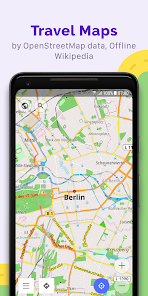
Komoot is a community-powered GPS navigation and route planning app tailored for outdoor adventures. Launched in Germany and now popular worldwide, Komoot helps you plan, navigate, and track routes for activities including road cycling, mountain biking, hiking, trail running, and even walking.
What makes Komoot unique is its focus on sport-specific route planning and exploration. Instead of just getting you from point A to B like a generic map app, Komoot finds paths that suit your activity (for example, avoiding highways and favoring bike paths or trails) and highlights interesting stops along the way.
Designed for both casual explorers and hardcore adventurers, Komoot is available on iOS, Android, and via a web interface, with seamless syncing across devices. The app taps into the extensive OpenStreetMap database to provide detailed maps and turn-by-turn navigation. It also leverages its large user community for crowd-sourced trail information.
Komoot users (cyclists and hikers alike) can mark “Highlights” (scenic points, trail segments, cafes, etc.) on the map and add photos/tips, which helps others discover must-see spots. This blend of reliable map data and community insight makes Komoot a powerful tool for discovering new rides and hikes.
In fact, one reviewer noted “Komoot is everything you love about Google Maps, but for cyclists”, offering a safe and efficient way to get around by bike. It’s not just for cyclists though – hikers and runners will find plenty to love, from topographic trail maps to curated route collections. Overall, Komoot is a versatile app that turns route planning and navigation into an accessible and fun experience for all kinds of outdoor enthusiasts.
Features of Komoot
Komoot is packed with features to help you plan and enjoy outdoor adventures. Below are some of its key features (with a focus on cycling) and how they enhance your experience:
1. Intelligent Route Planning for Multiple Sports
Komoot’s route planner lets you create custom routes by simply selecting a start and end point (and any waypoints in between). You begin by choosing your sport – e.g. road cycling, mountain biking, hiking, running – and Komoot will automatically calculate a route optimized for that activity.

The app prefers bike-friendly roads and trails: for cyclists, that means favoring bike paths or quiet roads over busy highways; for hikers, it sticks to established trails. It even takes into account your fitness level and chosen sport to estimate travel time. The result is an efficient, tailor-made route for your needs.
In fact, Komoot draws on the open-source OpenStreetMap data to map out roads, singletracks, and paths, adjusting the route based on surface type and difficulty so you know what you’re getting into. This smart planning is a huge leap from generic routing apps – one cycling reviewer noted Komoot is the answer for anyone “who’s ever wondered how to get from A to B on their bike as safely and efficiently as possible”.
2. Detailed Route Information (Elevation & Surface Analysis)
When you plan a route, Komoot gives you a wealth of information to help you prepare. You can view an interactive elevation profile of your entire route, with total ascent/descent and a breakdown of each climb and descent.
The app also shows the surface types (e.g. asphalt, gravel, dirt) and waytypes (bike path, road, trail, etc.) for each segment of your route. This level of detail means no more surprises like hitting an unrideable gravel section on your road bike – Komoot makes it clear where those segments are.
You can scrub along the elevation profile to see where big climbs are, and even identify potential hurdles (one reviewer mentioned Komoot alerted them to things like movable bridge crossings along the route. All this info is displayed in a user-friendly way in the planning interface. For example, the app might show that your planned 50 km ride has 10 km of paved bike path, 5 km of gravel, and 500 m of singletrack, along with markers for viewpoints or trailheads.
Komoot provides detailed route previews, including an elevation profile and trail surface types, so you know exactly what to expect on your journey. With this insight, you can tweak your route (drag and drop points on the map) to avoid or include certain terrain before you head out. It’s a level of planning detail that sets Komoot apart from simpler map apps.
3. Turn-by-Turn Voice Navigation
Once your route is planned, Komoot can guide you in real time with turn-by-turn navigation, just like a car GPS but optimized for outdoor use. The app offers voice navigation that clearly calls out turns and directions, which is great for cyclists who don’t want to be constantly looking at their phone.
Komoot’s navigation is built with trails and bike routes in mind – it will say things like “Turn left onto the forest trail in 200 meters” or “In 50 feet, bear right onto the bike path toward downtown”, which is incredibly helpful if you’re in an unfamiliar area. The voice cues are timed well; one cyclist noted the guidance kicks in about 50 feet before a turn, giving you ample warning.
If you do miss a turn or go off-course, Komoot shines with its fast recalculation – it can almost instantly reroute you and tell you how to get back on track. This quick re-routing is crucial when you’re, say, speeding down a hill and accidentally pass a trail junction. The navigation screen in Komoot’s app also displays useful live data such as your current speed, distance to next turn, and distance remaining.
Overall, Komoot’s turn-by-turn navigation has earned praise for being reliable and cycle-friendly, even in dense trail networks. (Tip: for safety, consider using a handlebar phone mount or earbud so you can hear directions without taking your eyes off the road.)
4. Offline Maps and GPS Navigation
One of Komoot’s killer features is its offline map capability. You can download map data for your route or an entire region to your phone, so you can navigate without any internet connection. This is a must-have for remote cycling tours, backcountry hikes, or anywhere with spotty cell service.
The app lets you save your planned routes and the corresponding maps in advance; once that’s done, the turn-by-turn navigation and map viewing will work offline just as well as online. Komoot’s offline maps are detailed and include topographic information, trail routes, and points of interest.
Even if you go off the pre-planned route, you can pan around the map to see where you are and plot a way out, all without data. The free version of Komoot includes one free offline region of your choice to get started, and additional regions can be unlocked via purchase (we’ll detail this in the Premium vs Free section).
In practical terms, offline functionality means you can rely on Komoot as your backcountry navigation tool – your phone’s GPS will track your location on the saved map, and you’ll get audio directions at each turn, no cell signal needed. Many users praise this feature; for instance, one cyclist mentioned “I love the offline data. It really works – I ditched my dedicated GPS device since using this app”, highlighting how Komoot’s offline maps allowed them to navigate accurately in areas with no coverage.
5. Community Highlights and Recommendations
A standout aspect of Komoot is its strong community and the Highlights feature. Highlights are essentially user-recommended points of interest (POIs) or segments on the map, marked with red dots. These could be anything from a great vista, a famous climb, a trailhead, a campsite, or even a bike-friendly café.

When planning a route, you’ll see these Highlights on the map and can choose to incorporate them into your journey. Komoot actively curates and delivers the most popular Highlights so that you “never miss another must-see” spot. For example, if you’re plotting a hike in a new area, Komoot might show you a nearby waterfall or scenic overlook that other users loved, which you can easily add as a detour.
This turns route planning into a bit of exploration inspiration – you’re not just drawing lines on a map, you’re discovering cool places to visit. Users can add their own Highlights with photos and tips, earning upvotes and even titles like “Pioneer” for contributing the best local knowledge.
The app’s feed and social features let you follow other explorers, view their recorded trips, and get ideas for your next outing.In essence, Komoot acts not only as a navigator but also as a source of adventure inspiration, fueled by a passionate community.
Hikers will appreciate the trail reviews and photos on Komoot, while cyclists might find new gravel loops or mountain bike trails recommended by locals. This community aspect is a big plus over using a standard GPS device or map – it feels like having millions of fellow adventurers helping you find the best stuff.
6. Activity Tracking and Sharing
Komoot doubles as a fitness and adventure log. When you head out on a ride or hike, you can use Komoot to record your Tour (Komoot refers to any recorded trip as a “Tour”). The app will use GPS to track your route, speed, distance, duration, and elevation gain in real time.
After the trip, you’ll have a detailed record on your profile. You can attach photos to your Tour, write a description or tips, and share it publicly or keep it private. Many users enjoy sharing their completed routes with the Komoot community or on social media – it’s a way to show off a great trail run or a bikepacking weekend and to archive your accomplishments.
Unlike more competition-driven platforms (such as Strava), Komoot’s sharing is more about storytelling and inspiration. You won’t see leaderboards or KOMs; instead, you see the journey and highlights.
Additionally, Komoot does integrate with fitness platforms: you can automatically sync your Komoot recorded activities to Apple Health, for example, or even to Strava if you want to keep all your workouts logged. For those who prefer using a dedicated device to record, Komoot can import GPX files or sync from Garmin, so you can plan in Komoot, record on your device, then have the nice Komoot visualization after.
The bottom line is that Komoot makes it easy to save and share your adventures, turning each ride or hike into a personal story on your profile that you (or others) can revisit later.
7. Multi-Day Tour Planning (Collections)
If you’re into bike touring or multi-day hikes (like backpacking trips), Komoot has a feature called Collections that is extremely handy. Collections allow you to group multiple routes (Tours) into a single organized trip. For example, you could plan a 5-day cycling tour by creating five separate daily routes and bundling them into one Collection.
Komoot lets you add descriptions for each day, bookmark the Collection, and share it as a package. This is perfect for long-distance trail hikes broken into segments or multi-day bikepacking journeys.
Premium users get advanced multi-day planning tools (like the ability to easily arrange and adjust stages), but even free users can create basic Collections for organizing routes. The interface might show, say, “Alps Bike Tour – Day 1, Day 2, …” each with its own stats. Having all your days’ routes in one place makes it simple to navigate sequentially and share the entire adventure with friends.
8. Device Compatibility and Sync
Komoot works across devices and plays well with popular cycling computers and wearables. The app syncs your routes and recordings to your Komoot account in the cloud, so you can plan a route on the Komoot website (which many find easier for fine-tuning routes on a bigger screen) and then have it automatically available on your phone app.

This cross-platform sync is seamless. Moreover, Komoot has dedicated integrations: it was awarded Garmin’s “Connect IQ App of the Year 2023” for its smooth integration with Garmin watches and bike computers. If you use a Garmin device, you can install the Komoot Connect IQ app to directly access your Komoot planned routes on the device and even get offline Komoot maps on certain Garmin models.
Similarly, Komoot syncs with Wahoo bike computers and Hammerhead devices – once linked, any route you plan can be sent to your device for navigation.
Smartwatches like the Apple Watch and Wear OS watches are also supported, allowing you to see directions on your wrist. The app’s ability to integrate means you aren’t tied to your phone screen if you prefer dedicated hardware for following routes.
Note: As of early 2025, Komoot now requires a Premium subscription for new users to sync routes to external devices like Garmin/Wahoo – we’ll explain this in the Premium vs Free section. Existing users who had the feature free are grandfathered in.
Despite that change, the device integration itself remains excellent. Many cyclists love planning on Komoot and then using their Garmin on the ride – it’s the best of both worlds in terms of planning intelligence and on-bike convenience.
These features together make Komoot a comprehensive tool for outdoor route planning and navigation. Whether you’re a cyclist looking for the next great loop, a hiker mapping out a national park trek, or a trail runner seeking new paths, Komoot’s feature set is geared to help you discover, plan, and navigate with confidence.
Komoot Premium vs Free Plan

One of the big questions potential users have is what you get for free on Komoot and whether upgrading to Komoot Premium is worth it.
Komoot operates on a freemium model: the core app and basic features are free, but certain maps and advanced features require either one-time payments or a subscription. Let’s break down the differences:
Komoot Free (Basic Plan)
Komoot’s free version is surprisingly robust. You can download the app for free and start using it immediately. With the free plan, you’re able to plan routes anywhere in the world online, use turn-by-turn navigation on your device, and unlock one offline map region for free.
A “region” in Komoot terms is a geographically small area (for example, a city and its surroundings or a county). Komoot typically offers your home area as the free region by default, but you can choose a different one if you prefer.
Within that free region, you can download the maps for offline use and get voice navigation without needing internet. Outside of your free region, you can still plan routes and even navigate them with voice cues if you have mobile data, but you won’t have offline capability unless you purchase the map.
All the community features (Highlights, sharing, viewing others’ content) and basic route planning tools are available in the free version. In short, free users get full access to Komoot’s routing engine and can enjoy navigation on one region offline.
Many casual users find that Komoot’s free plan is enough for local adventures, especially if you mostly ride or hike in your home area. As one outdoor blogger noted, “the free version is incredibly robust”, giving you a wealth of functionality before ever paying.
However, as your ambitions grow (traveling to new regions, going off-grid, or multi-day trips), you might bump into the limits of free Komoot.
One-Time Region Purchases
Komoot offers a flexible option to buy maps for offline use without subscribing to Premium. If you only need a few areas, you can purchase offline map regions à la carte.
The pricing (one-time fees) is roughly: Single Region for about $3.99 (covers a city or small area), Region Bundle for around $8.99 (a larger area, e.g. multiple counties or a state), and World Pack for ~$29.99 which unlocks offline maps worldwide. These purchases are lifetime – once bought, you have those maps forever.
For example, if you’re going on a trip to another state or country, you could buy that region’s maps for a few bucks and have offline access. Many people have taken advantage of the World Pack one-time purchase; at about $30 it grants offline maps for the entire globe for life.
This is a good deal if you don’t care about the extra features of Premium but want offline capability everywhere. It’s also a way to avoid a subscription if you prefer a one-and-done purchase.
Keep in mind these one-time purchases do not include the special Premium features like multi-day planning tools or live tracking – they only unlock the maps.
Komoot Premium (Subscription)
Komoot Premium is an annual subscription (approximately $59.99 per year, which is about €59.99 or £4.99/month if paid monthly). Premium includes everything in the free version plus a suite of advanced features and perks.
Notably, Premium automatically includes the World Pack of offline maps, so you get offline access to all regions without buying them separately. Beyond maps, here’s what Komoot Premium offers:
Multi-Day Tour Planning: Premium allows you to use a specialized planner for multi-day routes. You can plan a long journey and Komoot will help split it into daily segments, suggest stopovers, and allow easy adjustments (like moving a waypoint to a different day). This is great for planning bike tours or thru-hikes.
Personal Collections: With Premium, you can create unlimited Collections (grouping of routes with descriptions) and keep some Collections private. Free users can make collections too, but Premium provides more organizational tools.
Sport-Specific Maps: Premium users unlock additional map layers, such as a cycling map, hiking map, and mountain biking map that highlight information relevant to each sport (like trail difficulty or cycling infrastructure). These topographic maps were developed with the help of experts to make it easier to differentiate trail types at a glance. For example, the hiking map might show footpaths and contour lines more prominently, whereas the cycling map might emphasize paved vs unpaved.
3D Maps (Route Flyovers): A fun Premium feature is 3D map visualization. You can see your planned route in a 3D view or flyover, which helps to visualize the terrain (useful in mountain areas). It’s more of a nice-to-have for planning, giving you a Google Earth-style perspective.
Weather on Route: Premium integrates a weather forecast for your planned tours. You can see predictions for each segment of your route (temperature, rain, wind) at your expected time of arrival. This feature helps you plan start times or routes based on weather conditions – for instance, knowing if a mountain pass might be rainy in the afternoon.
Live Tracking: Komoot Premium includes a Live Tracking feature where you can share your real-time location with friends or family while on a tour. This is a safety and convenience feature – others can follow along to see where you are on your route. You simply send them a private link. It’s great for letting a loved one monitor your progress on a long solo hike, or for a group to keep tabs on each other.
Komoot on Garmin (and other devices): As of early 2025, sending routes to external devices (Garmin, Wahoo, etc.) now requires Premium for new users. This was a controversial change (previously it was free), but essentially if you want to sync your Komoot routes to a Garmin watch or bike computer, you’ll need Premium active. Premium also enables Live Sync with Garmin and Bosch devices, meaning your recordings sync back and forth automatically. Additionally, Premium lets you use the Komoot maps on Garmin devices even if the device doesn’t have its own maps.
In terms of cost-benefit, Komoot Premium at ~$60/year is a bit pricier than some competing apps’ subscriptions (AllTrails, for example, is around $35/year for Pro).
However, Komoot Premium is offering a wide array of functionality, essentially catering to power users who are frequently out exploring new places.
If you are an avid cyclist who travels to ride, or a backpacker planning multi-day treks, Premium can be very worthwhile. It eliminates the need to buy maps piecewise and gives peace of mind with live tracking and weather info.
On the other hand, if you mostly stick to your region or only occasionally venture out, you might get by with the free plan plus a one-time purchase or two for maps.
Use Cases:
Free Plan is Best For: Casual users, local riders and hikers, or anyone wanting to test the app. If you do most of your activities in one area and don’t need fancy extras, the free plan plus the free region offline map could serve you well indefinitely. You’ll still be able to plan routes, navigate with voice, and enjoy community content. For example, if you’re a runner who only occasionally does trail runs out of town, you might just purchase those specific region maps as needed for $3.99 each and skip Premium.
Premium is Best For: Enthusiasts and explorers. Cyclists who travel or bike tour frequently, mountain bikers who hit new trails often, hikers planning multi-day trips or who want the best topo maps – these folks will benefit from Premium. The yearly fee can quickly pay off if you would have bought many regions otherwise. Also, if you own a Garmin/Wahoo and are a new Komoot user, Premium is essentially required now to sync routes easily, so that might decide it for you. Premium’s live tracking and weather are also valuable for safety if you venture into remote or challenging environments.
In summary, Komoot’s free offering is generous enough that you can thoroughly try the app without paying. If you love it and find yourself craving more maps and features, Premium is there to unlock Komoot’s full potential. The nice part is Komoot gives you options – subscription or one-time map purchases – so you can choose what makes sense for your wallet.
User Interface and Usability
Komoot earns high marks for its user-friendly interface across both the mobile app and web platform. The design is clean, modern, and generally intuitive once you get the hang of it. That said, Komoot is a feature-rich app, so new users might feel a bit overwhelmed at first.
One App Store reviewer mentioned “It was difficult when I first started using the app… You have to familiarize yourself with each feature. After a few rides I am slowly using my previous app less and less. This app is very good for planning a ride”.
This reflects a minor learning curve: there are lots of menus and options (plan, discover, record, etc.), but they are logically organized.
Route Planning Interface
On the mobile app, planning a route involves tapping the “Route Planner” (or the “+” to create a new Tour), then selecting your sport and adding waypoints. The interface is very visual – you see a map and can search for locations or simply long-press on the map to set start/finish points.
There’s a handy search bar at the top where you can type an address, place name, or POI. The web interface is even more powerful: you can drag points around with your mouse, and use filters for road cycling, touring bike, MTB, hiking, etc., with Komoot snapping the route to suitable paths.
As noted by Bicycling magazine, “Planning bike rides on your phone is orders-of-magnitude easier in Komoot relative to competitor apps, though it’s still easier to adjust those routes on a computer. The interface allows you to drag the route to preferred locations—much like Google Maps, but with route-specificity beyond what even Strava offers”.
This sums up the planning experience: very flexible and precise. You can add intermediate stops (waypoints) by tapping the map or using the search (for example, search “coffee” and drop a pin where you want to stop during your ride). Komoot will then incorporate that into the route seamlessly.
Another neat usability touch: if you want to follow someone else’s route, you can easily copy it to your planner (assuming it’s shared) and modify it for yourself.
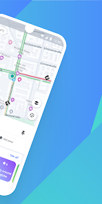
Map Display and Controls
Komoot’s map is optimized for outdoor use. It uses clear symbols and color-coding: trails are marked, cycling routes are highlighted, and surfaces are indicated (dashed lines for unpaved, etc.).
You can toggle various map layers; for example, on mobile there’s a “Map Type” button to switch between Komoot’s default (which is like an outdoor topo map) and alternatives like satellite imagery or specialized cycling maps (Premium). The interface also has an option to turn on Trail View, which shows photos of the trail segments if available, giving you a visual preview of conditions.
While planning or viewing a route, you can slide up the panel that shows stats (distance, elevation) and see the interactive elevation graph. Everything generally responds quickly and feels smooth.
The app also caches maps you’ve viewed, so even if you don’t explicitly download a region, the areas you looked at while online might still display if you lose signal – a thoughtful touch.
Navigation Mode
Once you hit “Start Navigation” on a planned route, Komoot switches to a dedicated navigation screen. This screen has a clear arrow for the next turn, written instructions (e.g., “Turn right in 100 m”), and fields like distance to next turn and distance remaining.
The background is the map which can be set to follow your location. You can also swipe to see an overview of the route if needed. During navigation, Komoot will beep or use voice instructions if enabled. An advantage Komoot has over some devices is the richness of on-screen data – speed, distance, ETA, etc., are available if you want them – yet you can also just ignore those and follow the arrows.
One user pointed out that if you prefer using your phone for directions, Komoot gives “a lot more readily accessible data than via your bike computer” and even allows on-the-fly rerouting with a quick map interaction. Essentially, the app’s navigation UI is both powerful and easy to follow.
Offline Use and Downloads
Downloading maps for offline use is straightforward. In the app, you find the region or specific route and tap download. The interface will show you how much space the maps take.

Once downloaded, the maps are labeled as available offline. Usability-wise, Komoot could do a better job informing new users about the one free region concept – some might not realize they need to choose their free region in settings.
But the support guides and onboarding usually prompt it. After that, managing offline regions is just a couple of taps.
Device Pairing
For those integrating with devices (Garmin, Wahoo, etc.), Komoot provides in-app instructions. Typically, you link accounts via the Komoot website or the device’s app.
Users have reported that pairing can take a few steps (as Bicycling’s tester noted with Garmin) but once set up, it’s smooth sailing – routes sync automatically.
The Garmin Connect IQ app for Komoot, for example, is quite user-friendly, allowing you to browse your Komoot routes on the Garmin unit and even pull data like surface type info.
General Look and Feel
Visually, Komoot uses a green theme (fitting the outdoor vibe) and easy-to-read fonts. The home screen of the app has tabs like Discover, Plan, Record, Profile, Premium at the bottom.
Discover shows suggestions and highlights in your selected region or from people you follow. It’s a nice way to casually browse for ideas.
The Plan tab is where you make routes, and Record is if you want to start recording without a pre-planned route (just free tracking your activity).
Everything is fairly self-explanatory, though as mentioned, first-timers should poke around a bit to understand all the options. Once you do, the app feels like a very “complete” toolbox.
According to one review, “Komoot’s user interface is designed with simplicity and functionality in mind… even new users can find and use features with ease”.
- Usability Pros: The app is polished and stable. Panning/zooming the map is fluid. Planning and editing routes is intuitive, especially compared to some older GPS devices or apps. Sync between web and phone is a big plus – plan on a desktop, execute on mobile. The search function is quite robust, recognizing trail names and POIs, not just addresses. Also, Komoot supports multiple languages, which is helpful since its user base is global.
- Usability Cons: A few minor points from user feedback: The initial learning curve as mentioned – Komoot has more features than, say, Google Maps, so it takes a few uses to become proficient. Another is that the battery usage can be significant during navigation – the screen and GPS on for hours will drain a phone, so long rides may require a battery pack (this is true of any such app, but worth noting). One forum user mentioned the app can be resource-intensive, sometimes causing older phones to heat up or in rare cases crash on extremely long outings. These instances are not common, but if you have an older device, you may want to occasionally save your ride or ensure you have a backup. Additionally, some Apple Watch users have reported issues with the watch app not syncing perfectly or getting stuck (as seen in an App Store review). The watch app functionality is somewhat limited (it’s basically for viewing navigation cues). The vast majority seem to use the phone or a dedicated bike computer instead, which is where Komoot excels.
In conclusion, Komoot’s interface strikes a good balance between power and simplicity. It’s feature-rich for those who want to dive deep (e.g., analyzing every inch of a route’s surface), but it’s also straightforward for those who just want to hit “Plan route” and go.
Once you get used to it, planning a route with Komoot can be done in minutes, and following that route is even easier. The company’s philosophy of making outdoor navigation “easily accessible and fun to use” really shines through in the app’s usability.
Real-World Performance
All the features in the world don’t matter if the app doesn’t perform when you’re out on the trail or road. Fortunately, Komoot largely lives up to its promises in real-world use. Here’s how it fares in various scenarios and some things to be aware of:
Navigation Accuracy
In practice, Komoot’s turn-by-turn navigation is accurate and reliable. Cyclists often praise how well it sticks to bike-appropriate routes and recalculates if you stray.
One cyclist who used Komoot on a 5,000 km (3,100+ mile) bike tour through Europe said, “Truly first class for cycle touring… it has been amazing. It has really been our only go-to map for over five thousand kilometers. It kept us on the cycling safe roads and helped us find sights”.
That’s a strong endorsement of Komoot’s routing engine – over a massive distance it consistently chose safe, bike-friendly roads and even pointed out attractions via Highlights.
In urban environments, Komoot tends to direct you along bike lanes, cycle routes, or quieter streets whenever possible. In rural or wilderness areas, it will use known trails and avoid dead-ends.
However, remember that Komoot’s data is largely from OpenStreetMap and user input, so occasionally errors or odd route choices can happen if the underlying map data is incomplete. For example, if a trail is mis-marked on OSM, Komoot might route you there thinking it’s legit.
These cases are relatively rare and the community often fixes map issues over time (Komoot might even suggest you update OSM if you report a problem).
“Scenic vs Direct” Routing
By design, Komoot might favor a more scenic route over the absolute fastest route. This is usually a good thing for recreational use – you’d rather bike on a pretty riverside path than a busy highway, even if it takes a bit longer.
But it’s worth noting for expectations: if you tell Komoot you’re biking, it won’t send you down a major road even if that road is the most direct, unless it’s truly the only option. Some users misunderstand this and think the navigation is inefficient when it’s actually prioritizing safety or enjoyment.
A Reddit user cautioned that Komoot “is a route planner and exploration app. It is not meant to get you to your destination directly or even safely.” – the wording is a bit harsh (Komoot does care about safety, but in their case they likely meant it can sometimes send you on rougher paths).
Essentially, Komoot will not always pick the same route as Google Maps might for a car; it’s selecting for the experience. Most find this a plus, but if you ever feel Komoot’s suggestion is too circuitous, you can manually adjust the route.
Offline Reliability
Using Komoot offline works very well as long as you have downloaded the maps for your region or planned Tour beforehand. The GPS tracking doesn’t drift significantly and the maps load quickly from local storage.
People have used Komoot offline in remote mountains, dense forests, even foreign countries with no cell service, and navigated successfully. One important tip: download your region or route maps before you go and double-check they’re saved (the app will show a checkmark for offline areas).
Also, it helps to keep your phone in at least medium battery mode since GPS can eat battery. In remote areas, consider carrying a backup battery if you’ll be out all day. But performance-wise, Komoot doesn’t require connectivity once maps are loaded – turn instructions and rerouting all work offline.
If you do stray far outside the area you have maps for, you’ll still see a breadcrumb of your path and compass, but no map detail until you reconnect or get that map. So plan accordingly.
Speed and Re-routing
One of Komoot’s strengths is how fast it recalculates routes. In real time, if you make a wrong turn or decide to take a detour, Komoot usually updates within seconds to redirect you.
The Bicycling test noted the recalculation is “almost instantaneous” and even tells you how far off course you are. In my own experience, this is accurate – a quick U-turn prompt if you’re close, or a new path if there’s a viable shortcut to rejoin later.
This speed is crucial when navigating tricky networks of trails or city streets. The app’s performance in this regard is on par with top car navigation apps, which is impressive given the complexity of off-road routing.
Urban Navigation
In cities, Komoot is very handy for cycling. It knows about bike lanes and cycle paths that services like Google Maps might ignore. It can also incorporate public transit if needed (for example, it might suggest taking a ferry across a river if that’s something cyclists commonly do in that city).
The turn alerts in a city are timely. One thing to be cautious about is GPS signal loss amid tall buildings – not a Komoot-specific issue, but any app can get a bit confused if GPS bounces.
Give it a moment and it usually corrects. City riders also appreciate that Komoot will tell you names of bike routes or paths (like “follow the Greenway Trail”) which local cyclists created – a nice touch over generic directions.
Trail Navigation
For hiking and mountain biking, Komoot’s performance is comparable to a dedicated hiking GPS. It shows your position accurately on the trail map. If trails are well-marked in the data, you’ll stay on track. Some deep wilderness trails might not be in Komoot’s map (though OpenStreetMap is pretty extensive), so always have a backup in truly uncharted areas.
The voice guidance is useful on a mountain bike when you can’t look down, though some prefer to just follow the line on the map in those scenarios. If you pause or go off-trail (intentionally or not), Komoot will handle it by either recalculating or waiting until you’re back. It doesn’t just shut off.
Many hikers use Komoot as a replacement for standalone GPS units now, given its reliability and the convenience of having your phone.
Use in Remote/International Areas
Komoot being globally used means you’ll find that it performs well almost anywhere there are mapped trails or roads. It’s particularly popular in Europe (its home turf), so the European trail and cycle network data is excellent.
Users in North America, Asia, and elsewhere have also adopted it. For example, if you go bikepacking in South America, you can download the world map and likely find Komoot’s directions valuable. Just remember to download offline maps to avoid data roaming.
Also, one advantage of Komoot over some rivals is the localization of units and language – it can display in miles or kilometers, and the interface is translated into many languages, making it more accessible in non-English-speaking regions.
The app content (like user tips) will still be in whatever language they were written in, but navigation instructions can be in your preferred language.
Battery and Performance Considerations
A common piece of feedback is to watch your battery. If you navigate for several hours, your phone’s screen and GPS are continuously active. Komoot doesn’t have a special low-power mode aside from what your phone provides.
On a long ride, it’s wise to either turn off the screen and rely on voice prompts (which saves battery) or have an external battery pack. Some cyclists mount their phone and let the screen stay on – in that case, consider dimming it a bit.
In terms of app stability, Komoot is generally stable. In earlier years there were occasional crashes on very long sessions, but recent versions have focused on bug fixes and performance improvements (release notes often mention improvements).
If your phone does reboot (like the Moto G5 example from a forum), Komoot will usually resume the navigation/recording when you reopen it, since it periodically saves progress. But such crashes are quite rare now.
User Experiences
The majority of user experiences indicate Komoot performs excellently. Cyclists report that voice nav helps them keep eyes on the road, and that Komoot’s choice of routes often reveals hidden gems – “it helped us find sights” as the touring cyclist said.
Hikers enjoy the confidence of seeing exactly where they are on a topo map in the middle of nowhere. One thing that comes up in user stories is how Komoot can change your approach: instead of sticking to known routes, you feel empowered to explore new areas because you trust the app to guide you back. This confidence is a huge intangible benefit of strong performance.
In summary, Komoot performs reliably in real-world navigation for cycling and other activities. It isn’t 100% infallible (no navigation system is), but it’s among the best in its class for keeping you on course and helping you discover great routes.
As long as you prep your offline maps and mind your phone’s battery, Komoot proves to be a dependable trail companion whether you’re biking across town or trekking through the wilderness.
User Reviews and Feedback

To gauge broader satisfaction, let’s look at what everyday users are saying about Komoot on app stores and online forums. Komoot enjoys high ratings on both Apple’s App Store and Google Play, reflecting a strong approval among its user base.
App Store and Google Play Ratings: On the Apple App Store, Komoot typically holds around a 4.7 to 4.8 out of 5 rating, and on Google Play it’s around 4.5 out of 5 with hundreds of thousands of reviews.
In fact, Komoot has been downloaded over 10 million times on Android alone and maintains about a 4.6★ average rating from users. These numbers already speak volumes: the vast majority of users find the app valuable.
Positive Feedback
Many users rave about Komoot’s route planning capabilities and reliability during adventures. For instance, one App Store reviewer mentioned, “It’s the app with everything you need if you’re a cyclist: the comprehensive map, accurate GPS tracking (including offline), detailed routes with specific elevation details… Just the perfect app to recommend!”
Cyclists often appreciate that Komoot caters to their needs better than generic apps – providing things like elevation profiles, surface info, and long-distance planning.
Another common praise is for offline functionality: “Awesome offline and online map… I love the offline data. It really works and [is an] accurate map. I ditched my speedometer since I found this app. Really cool”. This suggests that Komoot actually replaced dedicated cycling hardware for some users because of its accuracy and features.
Hikers and runners also chime in: “To everyone who loves cycling, running, hiking… I’d like to recommend this app called Komoot. It’s honestly the best. From navigation to elevation, it has everything you need. Best app on my phone right now”. That quote captures the sentiment of a lot of enthusiasts who find Komoot all-in-one and reliable.
People mention that they feel more confident exploring new areas with Komoot as their guide. The community aspect gets shoutouts too – users like seeing Highlights and tips from others, making them feel part of a larger adventure community.
Long-term users say that Komoot has continually improved. The interface updates and bug fixes over time have made it smoother. It’s also worth noting Komoot’s popularity in Europe: numerous reviews in various languages echo similar positive themes, implying that across different regions the app is solving the same problems successfully.
Critical Feedback
No app is perfect, and Komoot has a few recurring criticisms, though they are relatively minor in frequency. One issue that pops up is the aforementioned Apple Watch syncing problem for some – a couple of users complained that the Watch app never goes past “loading”.
This indicates some inconsistency in the companion app, which might frustrate those who expected full Apple Watch navigation (Komoot can display directions on Apple Watch, but it might not be as smooth for everyone).
Another point is the Premium upsell and paywalls. Some free users feel certain features are locked behind Premium that they wish were free (for example, some complained when Komoot moved Garmin sync to Premium). On Google Play, you’ll find a few reviews lamenting “Komoot used to let me do X for free, now it asks for Premium.”
This mainly affects new users due to policy changes. While the majority still love the free functionality, there’s a pocket of sentiment that the subscription is a bit pricey if you only need one feature from it.
However, Komoot’s team has tried to communicate these changes and grandfathered older users, which has mitigated backlash somewhat.
Routing complaints are rare, but you might see one or two users say Komoot’s suggested route wasn’t ideal – e.g., took them on a rough path or through an area they felt wasn’t safe.
This often ties back to user familiarity with the tool; by default Komoot assumes you want an interesting route. For instance, a user might write, “It took me through some bumpy dirt roads on my road bike – not what I wanted.” In such cases, the user may not have realized they can adjust the sport profile or route.
When these come up, other experienced users or support often respond with tips to correct it.
Support & Updates
Many users appreciate Komoot’s active development and customer support. The app is frequently updated (bug fixes, new features). If you look at version history, they push updates often to refine the experience.
On forums and review replies, Komoot’s support team usually addresses issues or guides users to solutions (like editing OSM data or using certain settings). This tends to foster goodwill in the community, as people feel the company listens.
Comparisons in Reviews
Some user reviews explicitly compare Komoot to other apps. A common one is vs. Strava – e.g., “I was a die-hard Strava user for years before, but Komoot has been more than positive for me. I use Strava less and less now for route planning.” (paraphrased from a review). This shows that for planning and navigation, Komoot often wins out over fitness-centric apps.
Another comparison is with Google Maps: users say Google might be fine for city turn-by-turn, but Komoot is far superior for finding bike-friendly routes or any off-road navigation. And AllTrails: hikers who try both note that AllTrails is good for finding existing trail guides, but Komoot is better for creating your own routes or combining trails.
One user on Reddit said, “I find some cool hikes on AllTrails and use Komoot or Gaia GPS for navigation. Komoot is still my personal favorite.”, highlighting that even when using multiple apps, Komoot often ends up as the actual navigation tool of choice.
Overall Sentiment
The overall sentiment from user feedback is very positive. Komoot has a loyal fan base of cyclists and hikers who credit it for enabling their adventures. The app holds an excellent reputation in the outdoor community for its reliability and rich features. Some quotes to summarize:
“Comprehensive and convenient – planning a route has never been easier.”
“A game-changer for cycle touring.”
“Reliable offline maps – never got lost on any hike since using Komoot.”
“It’s like having a local guide with you, wherever you go.”
The few areas for improvement (watch app, minor routing quirks, cost of Premium) are far outweighed by the benefits users experience.
In user forums, when someone asks “What’s the best app for route planning or navigation for cycling/hiking?”, Komoot is frequently recommended at the top of the list. That consensus is reflected in its high app ratings and user growth.
Komoot vs Alternatives
How does Komoot stack up against other popular outdoor navigation apps? Here we’ll briefly compare it to a couple of key competitors – AllTrails and Gaia GPS – as well as touch on others like Strava or Google Maps where relevant.
Each of these apps has its own strengths, but Komoot holds its ground strongly, especially for a cyclist-centric and multi-sport use case.
Komoot vs AllTrails
AllTrails is a well-known app especially among hikers and trail runners. It offers a huge database of pre-made trail routes, complete with user reviews, photos, and info on trail conditions. In essence, AllTrails is fantastic for discovering existing trails – it’s like a library of hikes. However, when comparing the two:
Route Planning: Komoot allows flexible creation of your own routes (connecting trails, roads, etc.), whereas AllTrails is more about choosing from listed trails or recording your activity. AllTrails does have a custom map drawing feature, but it’s not as advanced or easy to use as Komoot’s route planner. A Reddit user summarized, “AllTrails is more like a hiking guide. Great for finding routes people have done. Gaia GPS is a complete map and navigation app. Komoot I find easiest for planning trails with and finding points of interest”. This implies that Komoot strikes a balance between the guide approach and full custom planning – leaning more towards planning.
Cycling: AllTrails is primarily hiker-focused (though they include bike trails too). Komoot, on the other hand, shines for cycling. If you ask “what’s the best app for cyclists?”, AllTrails wouldn’t be the top answer – Komoot or others would. So for road cycling, gravel grinding, bike touring, Komoot has a clear advantage in features and community. AllTrails might have some popular bike routes, but it lacks turn-by-turn voice navigation for biking that Komoot has.
Offline Maps & Subscription: AllTrails’ free version lets you browse trails, but to use offline maps and unlock all features, you need AllTrails Pro (about $35.99/year). Komoot, as we saw, gives one region offline for free and the option to buy maps or subscribe to Premium (~$60/yr). AllTrails’ subscription is cheaper, but its functionality is narrower. For example, AllTrails doesn’t offer turn-by-turn navigation with voice; it’s more about following your position on a trail line (you have to watch the map). Komoot’s active navigation can be more useful, especially for cycling or complex trail networks.
Trail Database: AllTrails claims over 300k trails listed, with reviews. Komoot doesn’t have a “trail search” by name in the same way; instead, Komoot has Highlights and user-recorded Tours you can browse, but it’s not as straightforward as AllTrails’ catalog. In areas with very popular hikes, AllTrails is great because you can read recent reviews about trail conditions, etc. Komoot might not have those textual reviews on every trail, but it might have some tips or photos via Highlights. So hikers sometimes use AllTrails to research a hike and then use Komoot to navigate or plan variations.
Community & Social: AllTrails has a community but it’s not as interactive (people leave reviews and photos on trails, but there’s less following or feed dynamic). Komoot fosters following friends, sharing entire adventures, etc. If you like a more social experience, Komoot feels more like a community of explorers, whereas AllTrails is more of a database with comments.
In summary, AllTrails vs Komoot – AllTrails is ideal if you want a ready-made hike with lots of user feedback (especially in North America where AllTrails is very popular), and you’re okay with a simpler navigation method. Komoot is better if you want to create/customize routes, need voice navigation, or are cycling.
They can complement each other: use AllTrails to find a cool trail, then Komoot to integrate it into a longer route or navigate it offline with voice cues. For most cyclists and multi-sport users, Komoot offers a more versatile platform.
Komoot vs Gaia GPS
Gaia GPS is another powerful app often used by hikers, backpackers, and off-road adventurers. Gaia is known for its extensive map layers (USGS topos, satellite imagery, avalanche layers, etc.) and is a favorite for backcountry navigation. Comparing Gaia and Komoot:
Mapping and Planning: Gaia GPS is like having a full GIS tool in your pocket. It’s excellent for plotting off-trail routes, analyzing terrain with various maps, and it’s very popular among backcountry hikers, mountaineers, and also for uses like overlanding. It’s more technical in nature. Komoot, while it has good maps, doesn’t offer the same breadth of map sources (e.g., you won’t get specialized layers like Gaia’s NatGeo Trails Illustrated maps). However, for most recreational needs, Komoot’s maps (especially with Premium’s sport-specific layers) are sufficient and easier to use. Gaia allows drawing routes too, but Komoot’s routing engine is more automated (Gaia historically required you to manually draw or snap to trails without turn-by-turn directions). So planning a long, winding bike route through multiple towns is far easier in Komoot where it will auto-route, whereas Gaia might require more manual plotting.
User Interface: Gaia is powerful but can be a bit complex, especially for casual users. Komoot’s interface is generally more user-friendly and modern for the average person. Gaia might appeal to the map enthusiasts who love fiddling with different overlays. If you just want to “get a route and go,” Komoot is often faster to get results.
Cycling Features: Gaia has been adding cycling and routing features, but it still lacks things like turn-by-turn voice navigation in the polished way Komoot has. Cyclists, especially road and gravel, usually gravitate towards Komoot, Ride with GPS, or Strava for planning rather than Gaia. Gaia can record bike rides and has maps, but it doesn’t have the community route sharing or cycling-specific data like Komoot. One might use Gaia to see, for example, a US Forest Service map for mountain biking, but use Komoot to actually route along those trails with ease.
Offline and Subscription: Gaia GPS is primarily a subscription model for its full features (around $40/yr Premium, $20/yr basic). It offers offline maps and tons of layers with that. Komoot’s offline access can be obtained free (one region) or with one-time purchases or Premium sub. Gaia’s strength is maps; Komoot’s strength is routing and community. Some hardcore adventurers use Gaia for mapping and Komoot for routing – for instance, plan a route on Komoot, then export GPX to Gaia to have it on a specialized topo map. But that’s perhaps overkill for most.
Community: Gaia doesn’t have the kind of community Highlights or shared route discoveries that Komoot or AllTrails have. It’s more of a personal tool. Komoot, being community-driven, might have the edge if you enjoy that aspect of seeing others’ adventures or contributing.
In short, Gaia vs Komoot – Gaia GPS is like a Swiss army knife for maps and is excellent for advanced users or those going truly off-grid who need specialized maps. Komoot is better for ease of use, active navigation, and multi-sport routing.
If you’re mainly hiking on established trails or cycling on roads/trails, Komoot covers everything you need with less effort. If you need to navigate off-trail or want highly detailed topo maps for, say, a remote wilderness expedition, Gaia might complement Komoot (or be your choice for that specific task).
Other Alternatives
Google Maps (and Apple Maps): For city cycling, Google Maps has a bicycle mode and it’s free, but it’s nowhere near Komoot in terms of route quality and information. Google won’t tell you about trail segments or give offline topo maps. Many cyclists find Google’s bike routes okay for commuting but lacking for recreation. Apple Maps is improving for cycling directions in some cities, but similarly limited scope. Neither provides the community content or offline capabilities of Komoot in the wild.
Strava: Strava is primarily for tracking and social competition. It does have a route planner and many people share routes, but it’s not focused on turn-by-turn navigation. In fact, many cyclists will plan a route on Komoot and then export to Strava or vice versa, as the two can sync. Strava’s live turn directions (if you use Strava on your phone) are basic compared to Komoot’s robust navigation. So Strava is great for analyzing rides or finding popular segments, but as a navigation tool it’s not as feature-complete as Komoot.
Ride with GPS: This is another cyclist-focused planner (popular with the road cycling community). Ride with GPS offers good route planning and cue sheets, but it’s more web-centric and its mobile app is mostly for following routes. Komoot’s advantage is its broader platform (web + mobile seamlessly, and bigger user base globally). Ride with GPS also charges for certain features (like offline) unless you pay for membership. Komoot’s interface might be more modern. Serious roadies might still use RidewithGPS especially for event planning, but Komoot has been catching on in that space too, especially as it gains more users.
Outdooractive and Others: In Europe, Outdooractive and Wikiloc are alternatives. Outdooractive (which merged with ViewRanger) is a direct competitor with a large trail database (especially in Europe) and is quite good for hiking and some cycling. Wikiloc is community-based route sharing globally (tons of user-recorded GPX tracks). Komoot often wins on interface and planning features, but if you’re looking for pre-recorded routes, those can be good sources. Some comparison info: AllTrails and Outdooractive have extensive trail databases, but require subscriptions for offline; Wikiloc has many free user tracks but not as advanced in guiding you. Komoot sits somewhat in the middle – providing planning, guidance, and a growing database of user content.
Overall, Komoot holds a strong position by combining elements of several types of apps: it offers the planning smarts of a navigation app, the discovery of a trail database, and the sharing of a community platform.
Its focus on cycling and multi-sport sets it apart from apps that might specialize in just hiking or just fitness tracking. So if you’re someone who does a bit of everything – cycling, hiking, running – Komoot might replace the need to juggle multiple apps. On the other hand, specialists might still pair it with other tools (like a birder might use Audubon app alongside Komoot for hikes, or a mountaineer might use Gaia for that one ascent).
But for the mainstream outdoor enthusiast, Komoot arguably presents the best all-around package. As one publication succinctly put it, the typical Komoot user’s goal is “exploration (and sometimes transportation), not competition”, making it ideal for people who “want to get places fast and in one piece, while getting to know their city and the wilds that surround it.”.
If you’re interested in deeper dives into alternatives, check out our Gaia GPS Review for a detailed look at Gaia’s capabilities, or see Best GPS Apps for Cyclists on our blog where we compare apps like Komoot, Ride with GPS, and Strava. We’ve also covered other offline navigation apps in our posts, so you can see how Komoot stacks up in the broader landscape.
But from an SEO standpoint: when someone searches “Komoot vs AllTrails” or “Komoot vs Gaia,” the answer is that Komoot is the better choice for versatile route planning and on-trail navigation, especially if cycling is in the mix, whereas AllTrails is better for finding ready-made hikes and Gaia is better for advanced mapping.
Pros and Cons
Let’s distill everything into some clear pros and cons of the Komoot app:
Pros
Excellent Route Planning & Navigation: Komoot offers powerful route planning for cycling, hiking, running, and more, with turn-by-turn voice navigation that is reliable and tailored to your activity. It’s like having a personal guide that picks the safest, most enjoyable route for you.
Detailed Maps & Offline Capability: The app provides detailed topographic maps with elevation profiles and surface info, so you’re well-informed before and during your adventure. You can download maps for offline use, ensuring you won’t get lost even without cell service. This is crucial for remote rides and backcountry hikes.
Cyclist-Friendly Features: Komoot is arguably one of the best GPS apps for cyclists, with bike-specific routing, data fields (speed, distance, etc.), and integration with bike computers (Garmin, Wahoo, etc.). It prioritizes bike paths and trail networks, which cyclists love. As one review said, “Komoot is everything you love about Google Maps, but for cyclists”.
Active Outdoor Community: The platform’s community features (Highlights, user photos, tips, and the ability to follow friends) add a lot of value. You can discover popular spots and get inspiration from others’ Tours, making Komoot not just a tool but a source of adventure ideas. It’s fun to contribute and see your own Highlights helping others, fostering a sense of community.
Multi-Sport & Multi-Platform: Komoot isn’t limited to one activity – you can use it for biking one day, hiking the next, even running or mountaineering. It’s available on iOS, Android, and web, with seamless sync. The ability to plan on desktop and navigate on phone (or export to a device) offers great flexibility.
Highly Rated and Continually Improving: Komoot has a strong track record (millions of users, ~4.5★ ratings) and the developers frequently update the app with improvements. It has gained trust for being reliable on long journeys (some users report using it for months on end while touring).
Cons
Advanced Features Require Payment: While the free version is very useful, many of Komoot’s advanced features are behind a paywall. Offline maps beyond the first region, worldwide maps, and features like multi-day planning or live tracking require either purchasing regions or subscribing to Premium. New users who want to sync routes to devices (Garmin/Wahoo) must subscribe, which has been a point of contention. In short, to unlock its full potential you’ll likely need to spend money – something to consider if you’re on a tight budget.
Learning Curve for New Users: Komoot’s plethora of features can be a bit overwhelming initially. Some users find the interface “difficult at the start” until they familiarize themselves. Understanding concepts like regions, highlights, and the planner tools might take a little time. However, this is usually a one-time hurdle; after a couple of uses it becomes intuitive.
Battery Usage & Phone Dependence: Using Komoot for navigation means relying on your smartphone (unless syncing to a device). Long activities with the screen on and GPS running can drain battery quickly. Also, in harsh conditions (heavy rain, extreme cold), using a phone can be less convenient than a dedicated device. Komoot tries to mitigate with good voice nav (so you can keep screen off), but the fact remains that prolonged use will eat battery, so you should carry a backup power source for all-day treks.
Occasional Map/Data Quirks: Komoot’s routing is only as good as the map data available. In less-traveled or poorly mapped areas, there may be occasional errors – e.g., routing onto a trail that is overgrown or a road that isn’t ideal for bikes. Some cyclists have found that the recommended route, while scenic, wasn’t the safest in their opinion. These instances are not common, and community feedback often corrects them, but it’s a slight con. It’s always wise to use your judgment and not follow blindly (true of any navigation app).
Limited POI Search & Trail Database vs. Specialized Apps: While Komoot has improved its POI search, it may not have as extensive a catalog of hiking trail descriptions as AllTrails or as many map overlays as Gaia GPS. If your use case is very specific (like finding only officially marked trailheads with reviews, or needing geologic map layers), Komoot might not cover everything. It’s a broad tool, which means highly specialized info might need supplementing from other sources.
Balancing the pros and cons, it’s clear the pros of Komoot far outweigh the cons for most users, especially those who value its strong points like route customization and navigation. The cons are either situational (e.g., battery drain can be managed) or the cost of doing business for such a feature-rich app.
Komoot App FAQ
Here we answer some of the most frequently asked questions about Komoot that users have:
Q: Is Komoot free?
A: Komoot is free to download and use at a basic level. With the free version, you can plan routes, use turn-by-turn navigation, and even download one free offline map region of your choice (so you have offline maps for that area forever).
The app makes money by selling additional map regions and via a Premium subscription, but you do not need to pay to start using Komoot. Many users enjoy Komoot’s core features without spending anything.
If you want offline maps for beyond your free region or extra features, you can purchase those separately. In summary, Komoot’s basic features are free – it’s very functional without a subscription, which is great for trying it out.
Q: What do you get with Komoot Premium vs the free version?
A: The free version of Komoot gives you full access to route planning for all supported sports, voice navigation, and one offline region.
Komoot Premium, which is a paid annual subscription, includes worldwide offline maps (all regions unlocked) and adds several advanced features: multi-day tour planning tools (for bike tours or long hikes), sport-specific map layers (specialized hiking, cycling maps, etc.), on-route weather forecasts, Live Tracking (share your location during a trip), and priority support.
Premium also is now required for syncing to external devices like Garmin (for new users). The free version is great for local single-day use or casual use; Premium is aimed at power users who frequently travel, do multi-day adventures, or just want all the extra perks and convenience.
Premium costs around $4.99/month (billed annually ~$59.99/year). You can also purchase maps one-time if you don’t want to subscribe. We provided a detailed breakdown in the “Komoot Premium vs Free Plan” section above, which you can refer to for specifics.
Q: Does Komoot work offline?
A: Yes – one of Komoot’s best features is its offline functionality. Komoot works offline as long as you download the maps for your route or region beforehand. When you have offline maps saved, the app will use your phone’s GPS to track you and provide turn instructions without any internet connection.
This is perfect for areas with no cell service (mountain trails, foreign countries, remote backroads). The voice navigation, map panning, and rerouting all work offline using the downloaded data. By default, Komoot lets you download one region for free, and you can buy more regions or get the world maps with Premium.
Many users have successfully relied on Komoot offline for multi-day wilderness treks and bikepacking trips. Just remember to download the needed areas to your device before you go off-grid, and you’re good to go.
Also, carry a battery pack if you’ll be out for very long, since GPS can use power. But in terms of app capability, Komoot is fully functional offline – you won’t be left hanging without cell signal.
Q: Is Komoot good for mountain biking and off-road trails?
A: Absolutely. Komoot is widely used by mountain bikers (MTB riders) and off-road cyclists. When planning a route, you can select the “Mountain Bike” or “MTB” profile, and Komoot will prioritize singletracks, forest paths, and trails appropriate for mountain biking.
It’s smart about trail difficulty if that info is in the map data. Komoot’s map shows elevation and trail type, which is crucial for MTB. It will help you find known MTB routes or connect trails into a loop.
Many mountain bikers love using Komoot to discover new trail networks – the Highlights feature often points out popular trail segments or bike parks. The app even has a specific map layer for mountain biking (available to Premium users) that highlights off-road trails more clearly.
And yes, Komoot works offline on trails, so you can navigate deep in the woods. Some hardcore mountain bikers might also use Trailforks or MTB Project (which are MTB-specific apps) for trail details, but Komoot holds its own and is often praised for its reliable navigation in the woods.
Just be aware that Komoot will rely on OSM data – in very small MTB trail systems, if the community hasn’t mapped the trails, they might not show up. But in most established MTB areas, they will.
In summary, Komoot is an excellent tool for mountain biking, offering route planning, navigation, and trail discovery for off-road adventures.
Q: Can I import or export routes (GPX files) with Komoot?
A: Yes. Komoot supports importing and exporting of routes in GPX format (as well as other formats like .FIT). If you have a GPX track from another source (say a friend emailed you a route, or you downloaded a trail GPX from a website), you can import it into Komoot via the website or app (under your profile “Planned Tours” you’ll find an import option on the website).
Komoot will then save it as a planned route, and you can navigate it or even edit it. Exporting is also easy – for any tour (planned or completed), you can tap “Export GPX” (on the web or share menu in app) to get the file. This is useful if you want to use the route on another device or app. For instance, some users plan in Komoot then export to a Garmin device manually (though direct sync is available for Premium users, export is an alternative).
The integration capabilities are quite good. Komoot can also auto-sync with other services: link it to Strava or Garmin Connect, and it can send your completed rides to those platforms, or receive planned routes from them. All in all, Komoot plays well with others – you’re not locked in.
Q: How does Komoot compare to Google Maps for cycling or hiking?
A: Komoot is specifically designed for outdoor recreation, whereas Google Maps is a general navigation app primarily for driving (with some cycling and walking features). Here’s the key differences:
Routing: Komoot’s routing for cycling/hiking is more informed about trails, bike paths, and scenic routes. Google Maps might give you a bike route, but it sometimes chooses busy roads or lacks knowledge of unpaved trails. Komoot knows these nuances and typically gives a safer/more enjoyable route for biking or walking.
Turn-by-Turn for Trails: Google Maps does not offer voice navigation on hiking trails or off-road paths – it’s mostly for streets. Komoot does turn-by-turn even on a mountain trail.
Offline Use: Google Maps allows offline maps for areas, but setting up a multi-point route offline is tricky, and it’s not really made for long hikes or rides offline. Komoot is built with offline outdoor use in mind.
Information: Komoot provides elevation profiles, surface types, etc. Google Maps won’t tell you how much of your route is gravel vs tarmac, or give you an elevation chart to prepare for hills – Komoot will.
Community & Discovery: Google has info on businesses and some photos, but Komoot’s community Highlights specifically focus on things like viewpoints, trail features, etc., which Google might not have. Komoot can inspire you to take certain routes because others recommended them for their beauty or challenge, rather than just because it’s efficient.
Multi-day and Recording: Google Maps doesn’t let you plan multi-day tours or keep a log of your adventures with photos. Komoot is much more oriented to that “adventure log” style.
In summary, Komoot is far better than Google Maps for cycling, hiking, and any outdoor route planning. Google Maps is fine for a quick city bike commute or finding an address, but if you’re going on a recreational ride or a hike, Komoot is tailored for that experience – it’s safer, more informative, and more reliable off the beaten path. Think of Google Maps as a tool for transportation, and Komoot as a tool for exploration.
Q: Can I use Komoot on my Garmin/Wahoo bike computer or smartwatch?
A: Yes, Komoot offers integration with many devices:
For Garmin: There is an official Komoot app on the Garmin Connect IQ store. If you have a Garmin Edge cycling computer or a Garmin sports watch, you can install the Komoot Connect IQ app. Once you connect your Komoot account, you can sync your planned Komoot routes to the Garmin and even download Komoot’s map onto the device. Garmin even awarded Komoot “App of the Year”, showing how well it works. Do note: as of 2025, new Komoot users need Premium to use the Garmin sync feature. Existing users who had purchased regions may still have syncing. If you prefer not to get Premium, you can always export GPX from Komoot and put it on the Garmin manually, but the direct integration is smoother.
For Wahoo: You can link Komoot to your Wahoo ELEMNT app. Then any route you mark for sync will appear on the Wahoo device. This, like Garmin, now requires a Premium subscription for new users (since it’s considered an external sync). But Wahoo integration historically has been straightforward once linked.
For Hammerhead Karoo: Komoot is integrated there as well (login on the Karoo to pull routes).
For Smartwatches: Komoot has an app for Apple Watch and Wear OS. The Apple Watch app lets you start a navigation and then see the turn-by-turn directions on the watch. It’s a companion to the phone (the phone does the GPS heavy lifting, the watch is a second screen). Some have had issues with it, but many use it to glance at directions without pulling out the phone. On Wear OS (Android watches), similarly you can get Komoot maps/directions on your watch screen. If you have a Samsung Galaxy Watch 4/5 or other Wear OS 3 device, there’s a native Komoot app there too.
For other devices: Komoot can sync with Sigma devices, Bosch e-bike systems, and more – they have a list on their website. It also connects to Bluetooth headphones (for voice cues).
In short, Komoot can be used on many popular outdoor devices, either through official integrations (which often require Komoot Premium now) or via exporting route files.
Many users plan in Komoot and then navigate on their Garmin/Wahoo to save phone battery and have a robust device on the handlebars. The combination works great, and Komoot’s integration is considered one of the best among route planning apps.
Those are some of the most common questions addressed. If you have other queries like “How to unlock the free region” or “How to follow friends on Komoot,” you can find answers in Komoot’s support section or community forums – Komoot has a helpful user base. But the above should clear up the main points most people wonder about before using Komoot.
Final Verdict
Is Komoot the right app for you? After this deep dive, the answer for most outdoor enthusiasts – especially cyclists – is a resounding yes. Komoot stands out as one of the best apps for hiking and biking routes due to its powerful route planning engine, reliable turn-by-turn navigation (even on trails), and rich feature set that caters to various outdoor activities. It essentially combines the functionalities of several apps into one: a route planner, GPS navigator, and social adventure-sharing platform.
For cyclists, Komoot is a game-changer. Whether you’re a road cyclist mapping a century ride, a mountain biker looking for new singletrack, or a bike commuter wanting a safer route, Komoot delivers with bike-optimized directions and detailed insights. It’s no surprise many consider Komoot a must-have GPS app for cyclists, often replacing more tedious tools or paper maps. The fact that it also excels for hiking, running, and backpacking makes it incredibly versatile. You can use Komoot on a weekend hike in the mountains and on your daily bike ride, all within the same app interface.
Strengths Recap: Komoot’s strengths lie in its comprehensiveness and user-friendliness. It makes advanced routing (like multi-stop or multi-day trips) simple. The offline maps give peace of mind in remote areas. The community aspect can turn a dull outing into an exploratory adventure by highlighting cool spots. And with continuous improvements and a large user base, it’s a platform that’s here to stay and get even better.
Who will love Komoot: If you love exploring outdoors, hate getting lost, or enjoy discovering new routes, Komoot is for you. It caters to both planners and free-spirits: you can meticulously plan or just hit record and wander, and Komoot has tools for both styles. It’s especially beneficial for travelers – if you’re visiting a new region, Komoot can quickly show you popular bike loops or hikes, then guide you turn-by-turn. Beginners will find it straightforward (after a brief learning period) and experts will appreciate the depth of information available.
Things to consider: If you’re very budget-conscious and don’t want to pay, Komoot will still serve you well in a limited capacity, but to unlock its full global potential, you might eventually invest in some maps or Premium. Also, if your primary interest is competitive cycling training metrics, Komoot isn’t trying to be Strava – it’s less about speed records and more about the journey. But you can always use it in conjunction with training apps.
In our assessment, Komoot truly lives up to its reputation as an “ultimate route planner” and navigation app for outdoor adventures. It strikes an impressive balance between ease of use and advanced functionality, which is why it has such broad appeal.
Ready to elevate your cycling and hiking experiences? Give Komoot a try – download the free app, plan a local route, and see how it transforms your next ride or hike. Whether you’re aiming for the summit of a mountain or just a scenic Sunday ride, Komoot can help you get there and back confidently.
It’s like having a personal guide and a community of adventurers in your pocket. So go ahead, plan that route and hit the trail with Komoot – your next great adventure is just a few taps away!
If you found this review helpful and want to explore similar apps, check out our other articles like the Gaia GPS Review for comparison, or our roundup of the Best GPS Apps for Cyclists for more options. But for most people craving outdoor exploration, Komoot is a fantastic starting point.